South Australia distribution operator SA Power Networks has used LiDAR to map river flooding water levels to support its network management.
The Light Detection and Ranging technology (LiDAR) technology, which is used to create 3-D maps of the Earth’s surface or other objects, was a first for SA Power Networks and the data was used to create a digital twin of the electrical assets and the associated environment.
SA Power Networks reports that as the scale of likely flooding of the River Murray in South Australia started to become apparent in early December 2022, there were two clear areas of focus in response – limiting the disruption of service to river communities and keeping the River communities, emergency service providers and the workforce safe during and after the event, all while conforming to legislated powerline clearances.
With this, the global geospatial intelligence provider Neara was commissioned to map the network.
Have you read?
Entering a new orbit of data
Satellite-powered vegetation management for the smart grid
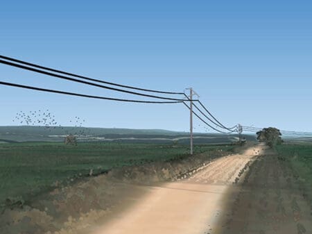
With 21,000 spans of lines along the 650km route of the Murray River across the state, this was to prove a significant undertaking.
A light aircraft flying at an altitude of around 400m was used over a five-week period to capture the LiDAR data associated with the assets located within the flood area, with conductors and their attachment points as the highest priority.
In this exercise, some trillions of LiDAR data points were captured at a resolution of 20 points per square metre. These were then classified by infrastructure type, i.e. pole, conductor, building, terrain, and merged with other data sources to create the digital twin of the network.
The data became available in late December as flood levels were about to peak, giving a 3D picture of the poles and wires and their relationship with water levels.
Modelling flood water impacts for network management
The flood water modelling proved the biggest challenge to solve and was achieved by ‘scraping’ data from various sources, including the Bureau of Meteorology and Murray Darling Basin Authority websites every five minutes for live water-level readings.
Once calibrated, the LiDAR data had a validated accuracy of about 220mm.
With this data, SA Power Networks was able to model the impacts on the network assets at various flood levels and to predict where and when powerlines would breach clearances or be inundated requiring electricity disconnection.
“By monitoring water and clearance levels daily, we were able to leave power on for longer for many customers along the river as the floodwaters rose significantly in December and also restore power more quickly as water receded,” says General Manager, Network Management, Doug Schmidt.
“This innovative approach, based on digital insights, allowed for the re-energisation of power lines within five days compared with the originally anticipated three-week time frame using traditional manual methods. The data also was an essential part of ensuring safety for the community, emergency service personnel and our people through the latter part of the flood event.”
SA Power Networks states that at the worst of the flooding – and the worst event since 1956 – 4,000 Stobie poles and 400km of powerlines were standing in flood waters.
Looking ahead SA Power Networks envisages being able to use the data to manage future flood events along the river, while the technology has other potential applications such as vegetation management, which will be investigated.