Paul French, Chief Commercial Officer at UK’s Ordnance Survey, describes how access to accurate location data can support utilities in futureproofing their networks for 2050 and beyond.
The UK has pledged to reduce its carbon emissions by 45% by 2030 and reach net zero by 2050, in accordance with its obligations under the Paris Agreement.
All eyes are on utilities providers as we transition to this net zero future, but it’s not as simple as flicking a switch and swapping to renewable energy generation.
Heat mapping
2022 was one of the hottest years on record in the UK, highlighting the effects of climate change on air temperature.
The UK is already leading the way in climate adaptation by using space data to monitor and understand the impact of climate change. For example, in a project backed by the UK Space Agency, Ordnance Survey is using satellite data to monitor and map heat in locations at greatest risk.
Have you read?
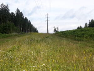
Satellite-powered vegetation management for the smart grid
Entering a new orbit of data
Revealing locations that are at greater risk allows local governments to plan better and implement effective policies to deal with extreme weather events. Accurate location data can also be used to optimise tree planting and land management, ensuring that planning is resilient to future change.
In cities, heat mapping can be used to find heat islands. These spots, where land surface is densely covered with roads, pavement, buildings and other surfaces that absorb and retain heat, could benefit from building adaptation. For example, retrofitting green roofs and green spaces could be used for heat pumps and as low carbon heat sources.
Heat mapping can also be used to enable community-driven energy generation, where an entire city or municipality create micro energy grids, powered by solar panels or nearby wind farms to help reduce demand on the national grid and lower its carbon footprint.
Asset planning
By 2030, it’s estimated that there will be between eight million and eleven million hybrid and electric cars in the UK, requiring 300,000 charging points. With just 37,000 existing in 2023, it’s clear that work is required to build this infrastructure.
For example, the Department for Transport, in conjunction with the University of Exeter, undertook a study to estimate the proportion of properties in a certain area that could accommodate private electric vehicle charge points powered by the household. Using Ordnance Survey’s geospatial data, combined with other data sets, an algorithm was developed that could be used to classify residential dwellings as potential locations for private charge points.
As the number of electric vehicles on the road increases, data like this will prove to be vital.
Also, for public use chargers, it’s important to see additional data, like how many houses exist within a postcode and what the electricity supply in that area is like. This will allow chargers to be placed in the most efficient locations.
Avoiding strikes
Around four million kilometres of pipes, sewers and electricity and telecoms cables are buried underground in the UK, accounting for a significant proportion of the nation’s utility, building and transport infrastructure. It’s estimated that every seven seconds a hole is dug to access these assets for repairs, upgrades and new installations.
The vast amount of holes dug, coupled with the unreliability of underground asset location data, means that there are around 60,000 accidental strikes per year, leading to injury, project delays and disruption to traffic and local economies. The total cost of these accidental strikes is estimated to be around £2.4 billion (US$3 billion) every year.
The lack of a single source of location data for underground assets has had a huge impact on the number of strikes over the years. While location data exists, it’s siloed in separate private companies, with data sharing between them often slow and inefficient.
To help combat this, the UK Government has established a Geospatial Consortium, of which Ordnance Survey is a member. The consortium has been working for a number of years to build a National Underground Asset Register as a single, secure data-sharing service to record the location and characteristics of underground assets.
The register will provide workers with an interactive, standardised digital view of the underground assets in a given location, reducing the risk of accidental strikes and resultant delays, costs and disruption.
Better service
With energy bills higher than in previous years, it’s important for providers to be aware of customers that require additional support.
Ordnance Survey is participating in a pilot to overcome this called the Priority Services Register. The pilot brings together data from various utilities providers to build a master list of all residents in Great Britain that might require additional support from their providers.
Once the list is aggregated, it will be disseminated out to all of the utility providers involved so that they can understand which of their customers are vulnerable.
While utility providers will have some insight already, the Priority Services Register will help ensure that every resident is provided with the support that they need, especially as our reliance on fossil fuels reduces and the way that households receive energy changes.
Achieving net zero emissions by 2050 is key to protecting our planet for the future. Accurate location data clearly has a key role to play towards meeting the challenges of this energy transition.
Ordnance Survey, the UK’s national mapping service, is a leading geospatial organisation and experienced geospatial partner for the national government and others around the world.